CENSUS DAY! Part 3 – Interstate Population Flows [INFOGRAPHIC]

Interstate Population Flows
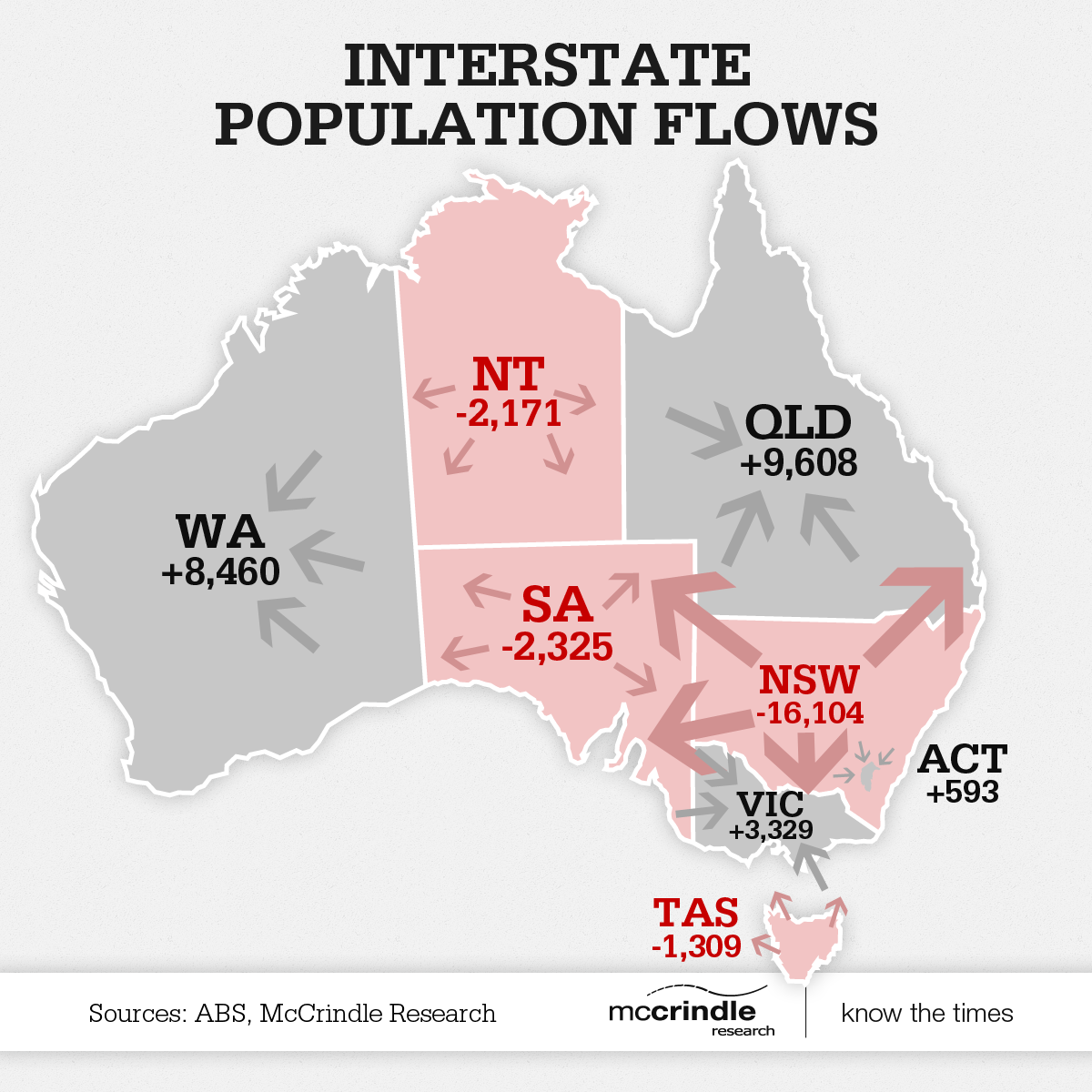
The map below shows the the movement of Australians as they move interstate. This shows a trend to the north (Queensland) and towards the west (Western Australia).
Mark McCrindle appeared on The Today Show this morning to give a quick snapshot of the figures shown in these infographics. Take a look-see to hear him explain the numbers a little more.
Watch Mark in more media segments on our Media page, or on our YouTube channel.
Click here to download the full Census Day infographic as a PDF.
For more information
If you found this article interesting, download our free McCrindle Insights Report for more information on the trends shaping the future of Australia.
For media commentary contact us on 02 8824 3422 or at [email protected]